yael c. agmon
Architecture/Experience Design/Strategy
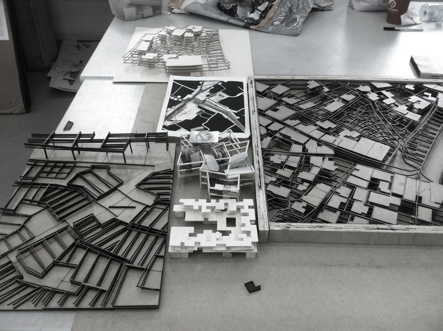
The DNA of Arab settlements


Rurban Ingrowth:
Rural+Urban Development of Druze Villages in Israel
#Urbanism #Sprawl #Architecture #Zoning #Planing
Technion, Haifa
Honorable Mention: Urban Design, 2012
Until recently, Daliyat al-Carmel and Isifya were rural Druze agricultural settlements isolated on the top of the Carmel range. Over the last century, significant changes have taken place among the Druze in the demographic, occupational, technological and cultural realms. Questions of identity raise new issues, both social and architectural, and beg new directions for growth and development, while preserving and strengthening unique cultural elements.
Due to a lack of public land within the settlement, construction is carried out along the margins on the land of the Israel Lands Administration. This trend will increase the “creeping” phenomenon and create the kind of suburban reality which the world is trying to correct. The Carmel Park is “left out” and with it the opportunity to redress the relationship between its administrators and the villages.
The proposal introduces public space into the village life in a way that does not limit residential development. In practice, these are private-public ventures, enabled by economic and social incentives, which occur by “hosting” in the land, as opposed to expropriating it. The ensuing growth and densification are essential to empowering the village itself and its relationship with the natural environment.
The first architectural act was to recognize the “sanctity” of land ownership, defined as “virtual volumes”. The next act constituted defining a set of rules for creating a development framework at each ownership volume in order to guarantee proper public space, while leaving the owner leeway for making choices. Development comprises three main layers: the lower, as public space and business facilities (urban), the upper, as green productive agricultural scape (rural), and the housing mass, in between. A separate structural system is proposed for each layer to enable development at different stages over time without the need of pre-planning.
This way, a living tissue is formed, consisting of a variety of uses at every point and allowing for the coexistence of intensive city life along with quiet village life, while retaining elements of traditional, detached home constructio