• Works
  • Research / Art
  • expertise
  • About

yael c. agmon

Architecture/Experience Design/Strategy

  • Works
  • Research / Art
  • expertise
  • About
מיפוי רצועת החוף (Large) (2).png

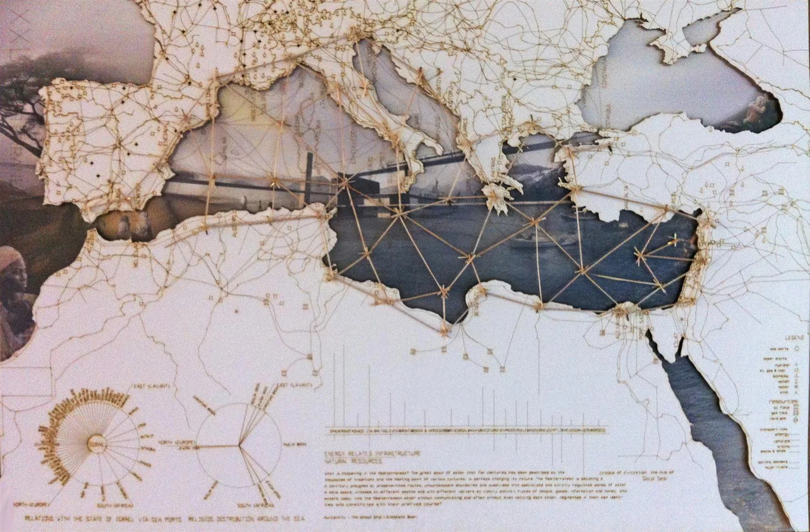
Re-Reading the Israeli Coastline through Infrastructural opportunities

#Architecture #Urbanism #Regional Planning #Infrastructure

Thesis Part I, Technion, Haifa
Collaboration with Igal Tartakovsky 

Finalist | Reiskin Award for Undergraduate Thesis

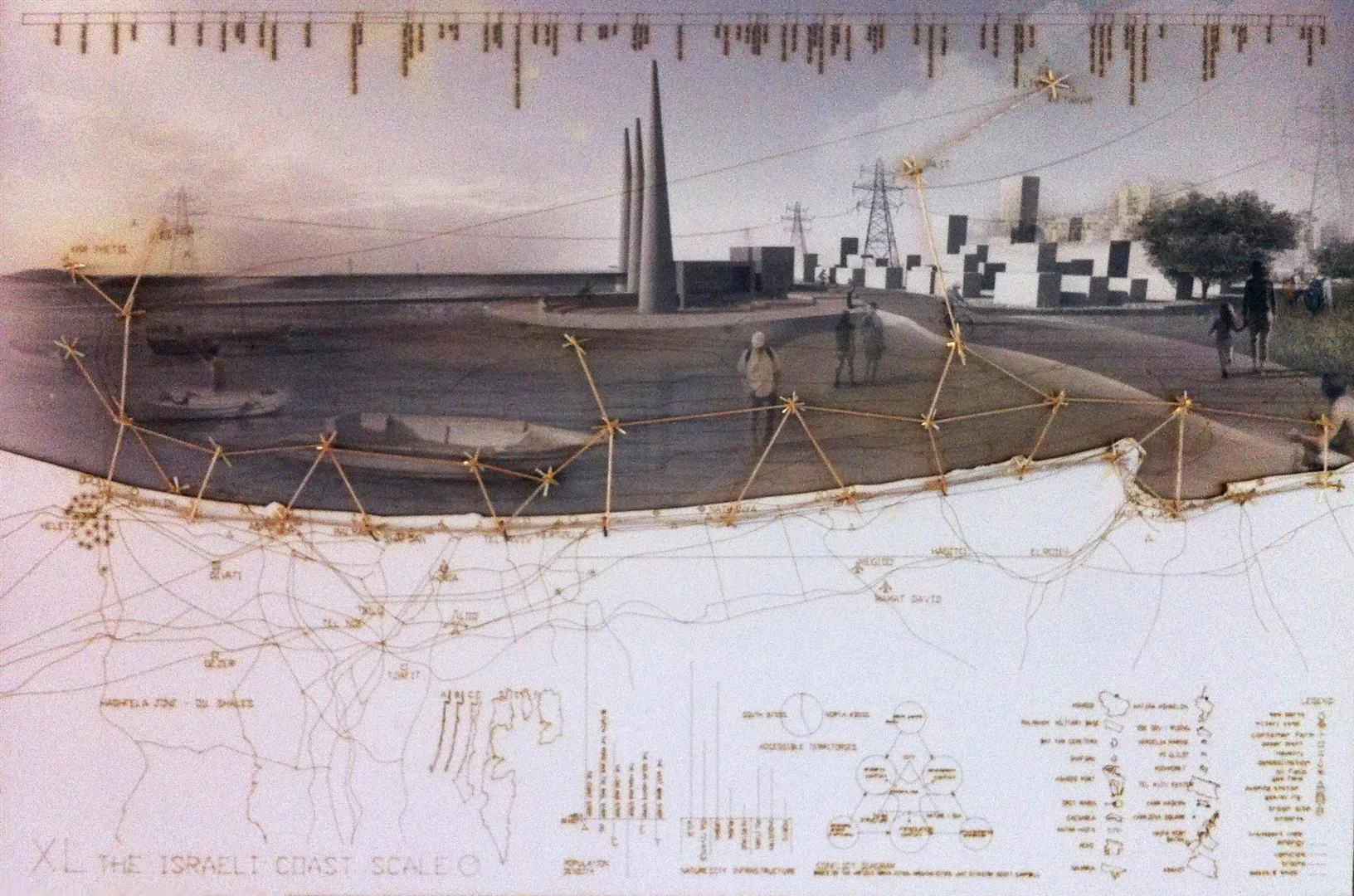
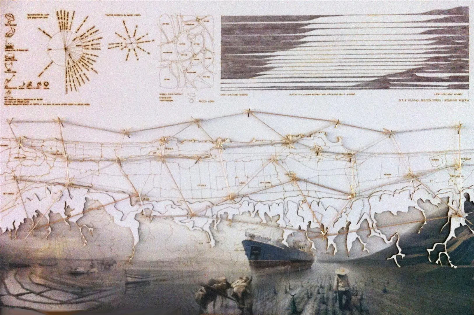
Infrastructural coastal sites, consisting of approximately a quarter of the Israeli 200 km coast, posses a significant challenge for planners. These sites usually block any public use or access to the sea, while functioning (or anti-functioning ) as black holes in the landscape. 

Following the common, super-functional planning approach in Israel these sites are usually designed as generic objects disconnected from any local characteristics.. In contrast, the project questions the specific interrelationships between coastal infrastructures' the local environment, and the sea, and seeks to emphasize the importance of planning constantly in various scales

As a case study, we chose a so-called a "coastal town", Atlit, that in fact has no access to the sea at all. The way to the sea is blocked by large infrastructures owned by powerful economic actors empowered by political interests.

 
View fullsize XXL - The Mediterranean Scale
View fullsize XL - The Israeli Coastline Scale
View fullsize L - The Carmel Coast Scale (Hof HaCarmel)
View fullsize M - Atlit's Coast Scale
View fullsize XXL - The Mediterranean Scale
View fullsize XL - The Israeli Coastline Scale
View fullsize L - The Carmel Coast Scale (Hof HaCarmel)
View fullsize M - Atlit's Coast Scale
View fullsize Mapping the diverse landscape textures of the Israeli coastline
View fullsize Mapping the mega-infrastructures of the State of Israel
View fullsize Scale comparison between mega-infrastructures and civilized areas along the coast
View fullsize Physical formations of the Israeli Coastline
View fullsize Atlit in Wonderland - juxtaposition of narratives over time
View fullsize Mapping of landscape patches in Atlit
View fullsize Urban scheme for Atlit #1
View fullsize Urban scheme for Atlit #2
View fullsize sea-land_final_2 (Large).jpg
View fullsize Energy production VS resources along the Mediterranean
View fullsize Geographical relationships along the Mediterranean
View fullsize Israel as an extension of Europe?
View fullsize Israel as part of the Levant?
 

Section B-B: blocked by linear transportation infrastructures

Section A-A : along the coastal highway


© Yael Agmon